


Météo-France uses Axis network cameras for remote monitoring
Axis Communications and TENEVIA help Météo-France monitor waterways for better flood protection.
Mission
Météo-France’s Flood Forecasting Service (SPC) for the East Mediterranean monitors waterways in the southeast of the country to anticipate flooding. The organization uses hydrometry, observation and measurement with underwater flow sensors. This can be tricky, difficult and sometimes even dangerous because of how quickly floods can arise. The task was therefore to provide a solution for measuring and observing this natural phenomenon regardless of the flow conditions.
Solution
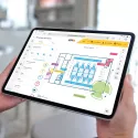
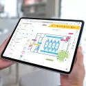
TENEVIA developed a solution for measuring the water height and surface flow speed using images filmed with AXIS P1357-E Network Cameras. After a test period at a university, this solution was connected to MétéoFrance’s camera installation at three different locations, one in Var and two in the Maritime Alps.
Result
The first results of this qualification phase are already conclusive. It allows Météo-France to monitor the waterways day and night and inform communities that might be affected by flooding.

Monitoring the power of nature
Météo-France’s mission is to monitor the flow of the waterways and to measure and anticipate flooding. For this, hydrometry performed by a local environmental authority is an indispensable tool. This flow rate is estimated using a height measurement and a relationship between the water’s height and flow. This relationship is based on measurements made by underwater sensors that measure the flow speed. However, things are not always that easy. The measurements can be tricky — even dangerous and difficult to implement, considering how quickly floods can arise.
TENEVIA RiverBoard® connects to Météo-France’s Axis cameras and uses images to measure the height of the water and the surface flow. After testing at a university, TENEVIA has brought its project to the industrial level. Evaluating the device involved installing several measuring points on the territory of the SPC East Mediterranean waterways, one in Var and two in the Maritime Alps.

Conclusive results
One of the solution’s first effects was the ability to compare measurements and visuals in real time, which makes it easier to understand phenomena associated with water. On the other hand, being able to monitor all day and night is an undeniable advantage. “Providing flood management crisis supervisors with images of the situation in real time is a definite improvement compared to a measurement that just provides uncertainty based on hard figures. Having an image in addition to the measurement is a real advantage,” explains M. Martin, project manager at the East Mediterranean Flood Forecasting Service and MétéoFrance’s southeast interregional department. “This solution is appreciated by those of us who are links in the alert chain and by the community
If a town in the region is about to be flooded, having a view of the sector(s) where the waterway is flooding is important for making decisions and managing the crisis more effectively.” These are the strong points that allow Météo-France to share its information with communities that might be hit by flooding. This is especially because the experiment, conducted since 2011, has had time to experience major flooding.
“This solution provides a more precise, reliable interpretation of the data. It combines ease of use and quality of image. We appreciate working with Axis Communications because, like us, they focus on research and development to deliver ever more powerful cameras. This allows us to focus on our core profession which is hydrology on the one hand, and on the other hand, analyzing the image in a natural setting,” says Brun.
Our TENEVIA RiverBoard® software is a measuring tool coupled with a solution to aid decision-making and monitoring of the waterway. Algorithms process the image and allow overflowing water levels to be detected automatically. This allows us to corroborate the digital information with the visual information the image provides. The system is especially effective when floods occur, because it continues to deliver verifiable information during unusual events.

An energy issue
This approach to hydrometry is based on analysis of images and generalizing with information that is simpler and more accessible, along with a measuring system tailored to extreme conditions. The current tools use a lot of energy, but they are already evolving to work at hard-to-reach measuring points, thanks to solar panels.
Products & solutions
Critical infrastructure

Smart cities

Banking and finance
Our partner organizations
Get in touch
Want to know how you can benefit from Axis solutions? Get in touch and we will help you.
Contact us