


Fighting damaging wildfires with smart technology
University of California San Diego’s ALERTCalifornia relies on rugged Axis PTZ cameras, and artificial intelligence to help firefighters detect and suppress wildfires, and manage cascading disasters like debris flows, floods, and erosion.

ALERTCalifornia helps detect wildfires early
The rise in massive wildfires in California continues to have a devastating impact on human lives and property and cause the state enormous ecological damage. Ongoing drought and prolonged heat waves have transformed traditional fire seasons into fire years. “Over the past two decades, we’ve not only seen an increasing number of fires, but a significant increase in the size of those fires,” shares Dr. Neal Driscoll, ALERTCalifornia director and professor of geology and geophysics at the University of California San Diego.
Driscoll was one of the original founders of ALERTWildfire – a consortium of universities, state and federal agencies, public utilities, wireless network providers, fire departments, and a host of businesses and citizen volunteers united in creating a technology-driven solution to improve fire spotting across the western United States. Eventually, California’s fire spotting network grew so large that it just made sense to create a separate ALERTCalifornia operation at UC San Diego.

“As we grew, we began focusing more attention on improving our own state’s program,” states Driscoll. “We added more cameras, introduced new sensor technology, and developed an artificial intelligence (AI) platform in concert with CAL FIRE and DigitalPath to help fire agencies target resources more quickly and improve public safety.”
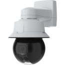
Today, UC San Diego’s ALERTCalifornia is working hand-in-hand with local, state, and federal agencies such as the US Forest Service and CAL FIRE (California’s Department of Forestry and Fire Protection), local fire departments, utilities, businesses, and citizenry to gather and disseminate real-time data. These data are captured by AXIS Q60 and Q63 PTZ Camera Series devices deployed on observation towers, LiDAR and FLIR imaging technology on airplanes and drones, and 9-1-1 alerts from the community. As Driscoll highlights, “We have a whole village, hundreds of cooperating organizations donating equipment and expertise to help ensure our resiliency.”
The success of the ALERTCalifornia program is in the fires you never hear about. Deploying Axis cameras and other sensor technologies greatly improves our odds of containment and suppression.
Creating a public network of detection technology
Professional Telecommunications Services (PTS), a certified SDVOSB and DVBE company, has helped UC San Diego deploy more than 1,200 Axis PTZ (pan-tilt-zoom) cameras on fire towers, towers, and private communications infrastructure across the state that stream live images to the ALERTCalifornia website. Firefighters and the public can log into the website 24/7 to monitor hotspots and growing conflagrations. The real-time images not only help the firefighting agencies determine when and where to roll trucks and personnel but also when to implement evacuation plans.

Equipping lookout towers for early detection
While no two sites are the same, most lookout stations include two AXIS Q60 Series PTZ Cameras looking at the area from two different angles to determine the field coordinates of the fire. Features like Forensic WDR (Wide Dynamic Range), OptimizedIR, and Lightfinder technology enable the cameras to see up to 112 kilometers on a clear day and up to 160 kilometers or more at night.
The addition of the AXIS Q63 PTZ Camera Series is helpful for providing additional situational awareness with its near infrared capabilities used to distinguish smoke from smog. To maintain self-sufficiency, many cameras operate under solar power with battery backup and are hardened against lightning strikes. The towers also include microwave links to transmit live images to the ALERTCalifornia website.
“We spin one of the cameras every two minutes and capture six frames per rotation,” explains Driscoll. “If the AI software spots any difference between frames, it alerts experts from CAL FIRE to look at the information and confirm if the change indicates smoke, ignition, a campfire, or nothing at all.”
Enhancing situational awareness
“The situational awareness we receive from the ALERTCalifornia cameras is, by far, one of our greatest assets,” claims Phillip SeLegue, Intel Program Staff Chief at CAL FIRE. “We use ALERTCalifornia in all 21 of our Emergency Command Centers. In 2025, the system alerted us to 3,600 fires. Over 50% of the time, we got those warnings before any 9-1-1 reports came in. That means we no longer have to wait for a human to identify potential fire activity. The cameras we have in place can detect early warning signs and send an alert immediately."
With these AI-generated alerts, CAL FIRE is often able to verify a fire, dispatch resources to the scene, and suppress the blaze even before the community is aware of the danger. Dr. Neal Driscoll emphasizes that this proactive approach is the core of their mission. “The success of the ALERTCalifornia program is in the fires you never hear about," says Driscoll. "Deploying Axis cameras and other sensor technologies greatly improves our odds of containment and suppression.”
In an environment where a spark can quickly flame out of control, these preemptive warnings are vital. Beyond the initial alert, the project delivers critical, real-time data as events unfold, driving better tactical decisions in Emergency Command Centers.
We use ALERTCalifornia in all 21 of our Emergency Command Centers. In 2025, the system alerted us to 3600 fires. Over 50% of the time, we got those warnings before any 9-1-1 reports came in.

Analyzing fire behavior and responder actions
The ALERTCalifornia system collects and stores petabytes of data every day that is archived at UC San Diego. This repository provides the firefighting community with valuable insight into the nature of fires and how to improve suppression. “Firefighters can go on our website and request historic footage by specific fires and windows of time,” explains Dr. Neal Driscoll. “We build them a video of that data so they can go back and study the fire’s behavior. They can also review how quickly the response team was deployed, whether the resources were sufficient, whether the fire was arson-related, caused by a lightning strike, or other event.”
Managing multiple demands for camera access
Because so many firefighting agencies share the ALERTCalifornia platform, Driscoll needed certain controls to be baked into the system to prevent multiple emergency managers from competing to move the same camera at once. PTS engineers and Axis Professional Services team worked together to create a special software application to document who was using the camera.
“With a program this large, real-time communication during incidents is critical,” states Driscoll. “If someone wants to move a camera’s direction, like a utility person or a firefighter, we want to know who they are and why they did it,” says Driscoll. “Now we have a banner running under each camera feed that tells us who moved the camera last and their agency affiliation. It helps us avoid several people trying to hit the same camera at the same time.”
The value of both the cameras and this innovation played out during the devastating 2025 Los Angeles Fires. With high winds blowing embers and new starts cropping up throughout the area, regional emergency managers were able to use the cameras continuously to monitor the larger Palisades and Eaton Fires, while simultaneously using the network to spot new incidents in real time.

Modeling the terrain for other risks
While multiple firefighting agencies tap into the ALERTCalifornia system for early fire detection, Phillip SeLegue notes that 24/7 observation of California’s terrain has spawned other uses for the technology. “The ALERTCalifornia cameras enable us to be more proactive about fire prevention,” declares SeLegue. “We use the imagery to measure fuel levels such as grasses and other brush dry out throughout the year. We add that data into our Technosylva fire modeling and fire spread prediction system to help us mitigate the risk of wildfires.” The agency also uses the cameras to monitor areas susceptible to flooding, mudslides, and other natural and human-caused disasters.
Other agencies such as the Department of Water Resources and the Fish and Wildlife Department, take advantage of the ALERTCalifornia cameras to monitor resources and structures under their management, such as levees and lake beds.

SeLegue sees the ALERTCalifornia website as a great public resource as well, beyond monitoring the path of an encroaching wildfire. “The more people who onboard the system, the more valuable it becomes,” assures SeLegue. For instance, small aircraft pilots often use the cameras to check conditions before flights, bird watchers can log on to catch sight of endangered California condors, and skiers can look at snow conditions on nearby slopes. Or people can just log on to ALERTCalifornia’s public camera site simply for the pleasure of watching the evening sky as the sun slowly dips below the horizon.
Helping to build a safer future for California
As the ALERTCalifornia system continues to demonstrate its versatility and value, it's clear that its impact extends far beyond the realm of wildfire detection. From informing land management decisions to enabling public engagement and education, the possibilities for this technology are vast. And yet, despite these successes, the true test of ALERTCalifornia lies in its ability to adapt and evolve in the face of an ever-changing landscape. As California continues to face the threat of destructive wildfires and other disasters, the ALERTCalifornia system stands as a beacon of hope.
Photos courtesy of ALERTCalifornia | UC San Diego